Drift Table Analysis for Debris
Sources: U.S. State Dept., Australian Transportation Safety Board
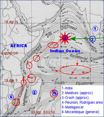
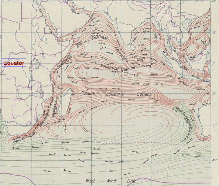
 Indian Ocean Currents. In the larger map below, observe the drift pattern in the main Indian Ocean Gyre that circulates counter-clockwise between western Australia and eastern Africa, primarily south of 15 degrees below the Equator. This is how authorities propose debris reached Africa. Compare with the map at right, showing comparable estimations for a proposed (Lemma 3) crash off western Maldives en route to Africa. I have shown in red a rough order of magnitude of proposed stairsteps in currents from the northern counter-gyre into the southern main gyre. My guess is the the time frames involved would be comparable, making either Lemma 2 (official) or Lemma 3 (my theory) equally plausible. Indian Ocean Currents. In the larger map below, observe the drift pattern in the main Indian Ocean Gyre that circulates counter-clockwise between western Australia and eastern Africa, primarily south of 15 degrees below the Equator. This is how authorities propose debris reached Africa. Compare with the map at right, showing comparable estimations for a proposed (Lemma 3) crash off western Maldives en route to Africa. I have shown in red a rough order of magnitude of proposed stairsteps in currents from the northern counter-gyre into the southern main gyre. My guess is the the time frames involved would be comparable, making either Lemma 2 (official) or Lemma 3 (my theory) equally plausible.
Lemma 3 Assumptions. Remember that, under Lemma 3, MH370 was already flying low and in trouble when seen by reliable witnesses in the Maldives (south of India) heading west toward Africa. Indications are the plane entered the ocean at relatively low airspeed, which sheered off the wings and possibly other externals but the fuselage sank mostly intact in situ. This explains why primarily wing or door debris have been found on or near African shores. The drift studies show currents leading to multiple African areas including Reunion, Mozambique, and the like. If authorities had searched west of Madagascar, and if Lemma 3 is the correct solution, then the craft lies on the abyssal plain south of Arabia. Not a shred of evidence has been found anywhere west of Australia, which casts grave doubt on official theories that are stubbornly held but have zero results.

|